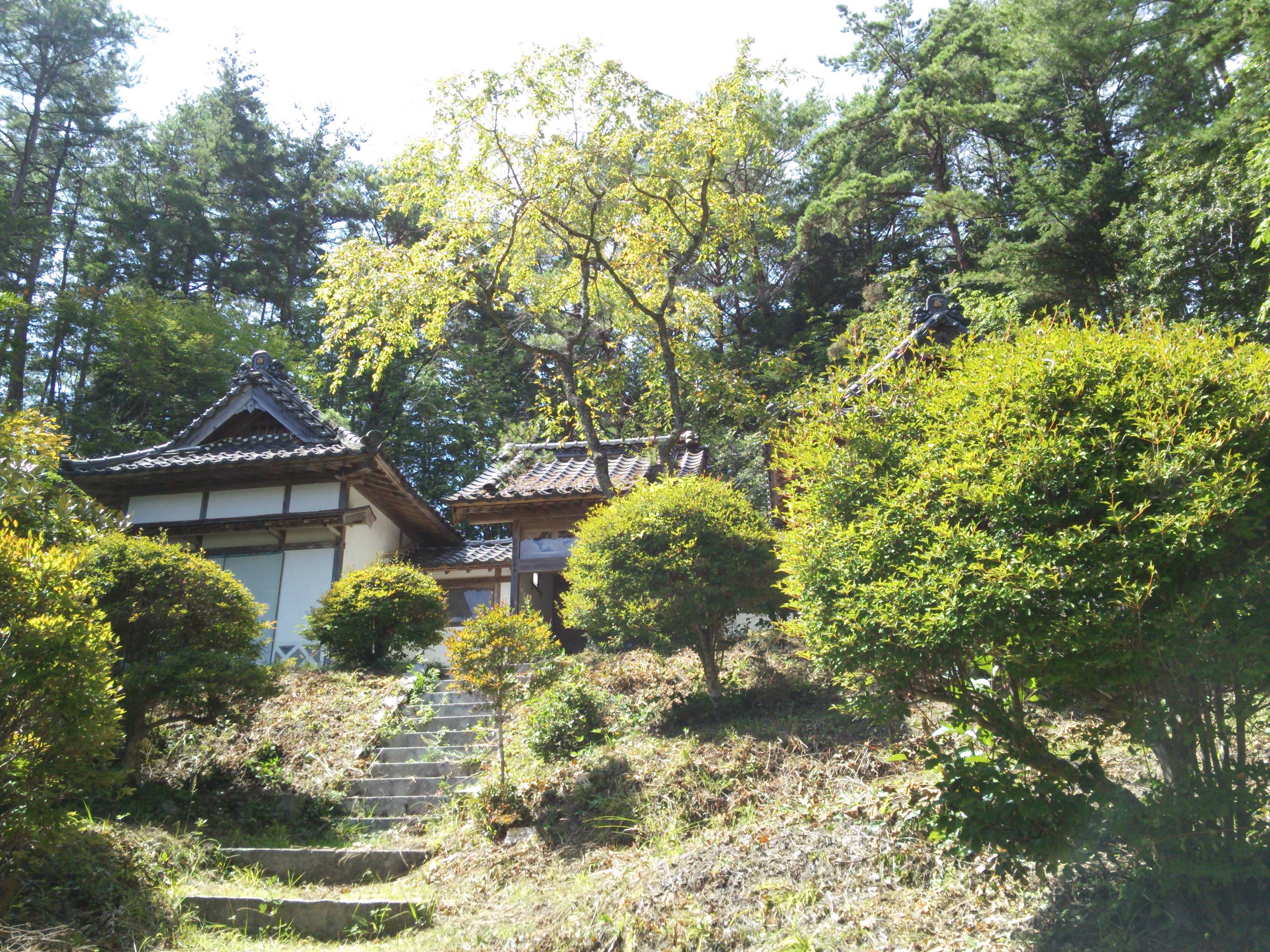
Exploring architecture and landscape across Chubu
Architecture in the Chubu region is shaped by encounters between dense cities, productive farmland, mountain settlements, industrial corridors, and broad coastal plains. Buildings rarely stand apart from these conditions. Their materials, circulation routes, environmental systems, and public spaces respond to terrain, climate, infrastructure, and local patterns of life.
For architecture students, this relationship offers a rich field of study. A graduation project can investigate how a school sits beside a forest, how housing adapts to heavy snowfall, or how a former industrial waterfront becomes civic ground. Such proposals reveal landscape as an active design medium rather than a decorative setting.
NAGOYA Archi Fes gives these ideas a public platform through its student-organized graduation exhibition and juried competition. By bringing together final-year projects from across the Chubu area, the event makes regional design thinking visible to students, educators, professionals, alumni, and visitors. Information about dates, venues, participation, and related programming is available through the event information.
Reading Chubu as a living territory
Chubu contains a remarkable range of landscapes within a relatively concentrated part of Japan. Nagoya’s metropolitan fabric connects to manufacturing cities, river basins, agricultural communities, alpine regions, and the Pacific coast. This geographical variety encourages architecture students to consider how a building participates in systems that extend far beyond its site boundary.
The region’s rivers provide one useful lens. The Kiso Three Rivers and other waterways have influenced settlement, flood control, agriculture, transport, and industry. A proposal near a river may therefore need to address seasonal water levels, evacuation routes, ecological restoration, and public access at the same time. Landscape architecture becomes inseparable from questions of safety, memory, and collective use.
Mountainous areas present a different set of conditions. Steep topography, forest management, snow loads, and depopulation affect the future of villages and public facilities. A small community center might serve as a gathering place, emergency shelter, tourism resource, and base for local forestry activities. The strongest projects begin by identifying these overlapping roles instead of treating the site as an empty plot.
Where building meets ground
The meeting between architecture and landscape often starts with the ground itself. Changes in elevation can guide movement, frame views, manage rainwater, and reduce the visual impact of a building. A project that follows a slope may preserve mature trees and existing paths, while a project that lifts itself above the terrain can protect drainage patterns or create a shaded public zone.
Edges deserve equal attention. The boundary between a building and a street, courtyard, rice field, forest, or riverbank can be designed as a gradual transition rather than a hard line. Colonnades, covered walkways, stepped terraces, planted thresholds, and semi-outdoor rooms allow people to experience changing weather and seasonal conditions. These spaces make architecture feel connected to its surroundings through use, not just through appearance.
Material choices can reinforce this connection. Local timber may reference forest economies and skilled construction traditions, while stone, earth, ceramic tile, and recycled industrial materials can express the character of a particular place. The question is not whether a material looks regional in isolation. It is whether its sourcing, maintenance, weathering, and construction logic contribute to a meaningful relationship with the landscape.
Student projects as landscape research
Graduation design projects are valuable because they often combine speculation with close observation. Students have time to question assumptions, map overlooked relationships, and test several spatial strategies before presenting a final proposal. Their work can expose possibilities that conventional development briefs might leave unexplored.
A project may begin with a territorial map showing flood zones, commuter movements, abandoned homes, ecological corridors, or changing agricultural practices. Models can then test how a new building affects wind, shade, water, and pedestrian movement. Drawings might describe daily routines across an entire settlement rather than focusing only on the building’s facade. This broader scale gives architectural work a social and environmental depth.
The exhibition format adds another layer of value. Visitors encounter many interpretations of similar regional issues, from compact urban housing to rural care facilities and adaptive reuse proposals. Comparing these projects helps reveal the assumptions behind each design: what counts as public space, whose movement is prioritized, how nature is represented, and how much change a community can absorb.
Professional jurors also bring practical and critical perspectives. They may question whether a proposal can be built, maintained, funded, or adapted over time. Those questions do not diminish the imaginative quality of student work. They help connect conceptual ambition with the physical and civic responsibilities of architecture.
A regional lens on climate and culture
Climate is a powerful link between architecture and landscape in Chubu. Hot, humid summers require shade, ventilation, and careful control of solar gain. Heavy rain makes roofs, gutters, permeable surfaces, and retention landscapes important. Snowy areas demand durable structures, sheltered entrances, storage for winter equipment, and circulation routes that remain usable in difficult weather.
Design responses can operate at several scales. At the building scale, deep eaves, operable windows, thermal insulation, and planted courtyards improve comfort. At the neighborhood scale, connected green spaces can absorb stormwater and reduce heat. At the regional scale, restored wetlands, forest stewardship, and agricultural infrastructure can support biodiversity while protecting settlements. The most persuasive proposals show how these scales reinforce one another.
Culture also shapes the meaning of landscape. A satoyama environment may be valued as a managed relationship between settlement, woodland, and cultivation rather than as untouched nature. Shrine approaches, traditional streets, industrial canals, and postwar housing estates each contain layers of memory. Students who study these patterns can create contemporary interventions that respect continuity without copying historical forms.
This balance is especially important in a public exhibition. Visitors may respond to a project through personal memories of a place, while jurors may focus on its spatial clarity or technical feasibility. A successful presentation makes room for both responses. It explains the site’s lived character while communicating a clear architectural proposition.
Comparing approaches across exhibitions
Projects can be compared through the questions they ask, the scales they address, and the forms of evidence they use. The following framework shows several common approaches to the relationship between building and landscape.
| Approach | Primary concern | Typical design tools | Value for Chubu contexts |
|---|---|---|---|
| Ecological repair | Water, habitat, and soil health | Wetlands, rain gardens, planted corridors, permeable ground | Responds to flooding, biodiversity loss, and urban heat |
| Cultural continuity | Memory, identity, and local practice | Reused structures, familiar materials, community spaces | Supports place-based renewal without simple imitation |
| Climate adaptation | Comfort, resilience, and seasonal change | Shade, ventilation, raised floors, snow-ready circulation | Addresses heat, humidity, heavy rain, and snowfall |
| Productive landscape | Food, forestry, and local economies | Shared fields, timber systems, workshops, market spaces | Connects architecture with regional livelihoods |
| Urban transformation | Density, mobility, and public life | Mixed-use edges, green networks, transit links, adaptive reuse | Reframes underused city and industrial sites |
These categories often overlap. A reused factory beside a restored canal may support ecological repair, cultural continuity, and new local enterprise at once. Similarly, a rural library can function as a climate refuge, a learning space, and a base for community stewardship. The categories are useful because they help viewers identify a project’s priorities without reducing it to a single theme.
Exhibition visitors can also look for the project’s evidence. Does the model show surrounding terrain or only the building? Do sections explain airflow, water movement, and public access? Do drawings indicate who maintains planted areas and how spaces change over time? These details help distinguish a compelling landscape strategy from a visual gesture.
Making the exhibition part of the conversation
Architecture exhibitions become more meaningful when visitors are treated as participants in a continuing exchange. A presentation board may communicate the designer’s intentions, but conversations at the venue can reveal practical concerns, emotional reactions, and local knowledge that were absent from the original brief.
Feedback is especially useful when it is specific. Instead of asking whether a project is simply attractive, visitors can comment on the clarity of its site analysis, the comfort of its public spaces, or the relationship between its environmental claims and its construction method. Exhibitors can prepare for this exchange by using several audience feedback methods that make responses easier to collect and interpret.
For students preparing their own work, a few habits can strengthen both design development and public communication:
- Visit the site in different weather conditions and record how people, water, shade, and sound change.
- Map connections beyond the plot, including transit, drainage, local businesses, public facilities, and ecological corridors.
- Use sections and physical models to explain the building’s relationship with terrain, climate, and movement.
- Describe maintenance, material sourcing, and future adaptation alongside the initial construction concept.
- Invite critique from people with different experiences of the region, including residents, students, practitioners, and non-specialist visitors.
These practices support a more generous understanding of architectural quality. A project does not need to solve every regional issue, yet it should make its position clear. It should show what it preserves, what it changes, who benefits, and how the landscape may evolve after completion.
The exhibition can also strengthen networks across schools and professional communities. Students discover different methods of research and representation, educators identify shared concerns, and practicing architects encounter emerging ideas. Visitors who are unfamiliar with architecture gain access to debates about housing, climate, mobility, heritage, and public space through tangible projects rather than abstract policy language.
The intersection of architecture and landscape in Chubu is therefore a field of relationships: between city and countryside, infrastructure and ecology, memory and innovation, individual buildings and collective systems. Student work makes these relationships visible at a moment when the region is negotiating demographic change, environmental pressure, and new forms of public life.
Explore the projects, attend the exhibition, and take part in the discussions that surround them. By looking closely at how buildings meet rivers, streets, forests, farms, and communities, every visitor can help expand the conversation about the future of architecture in Chubu.