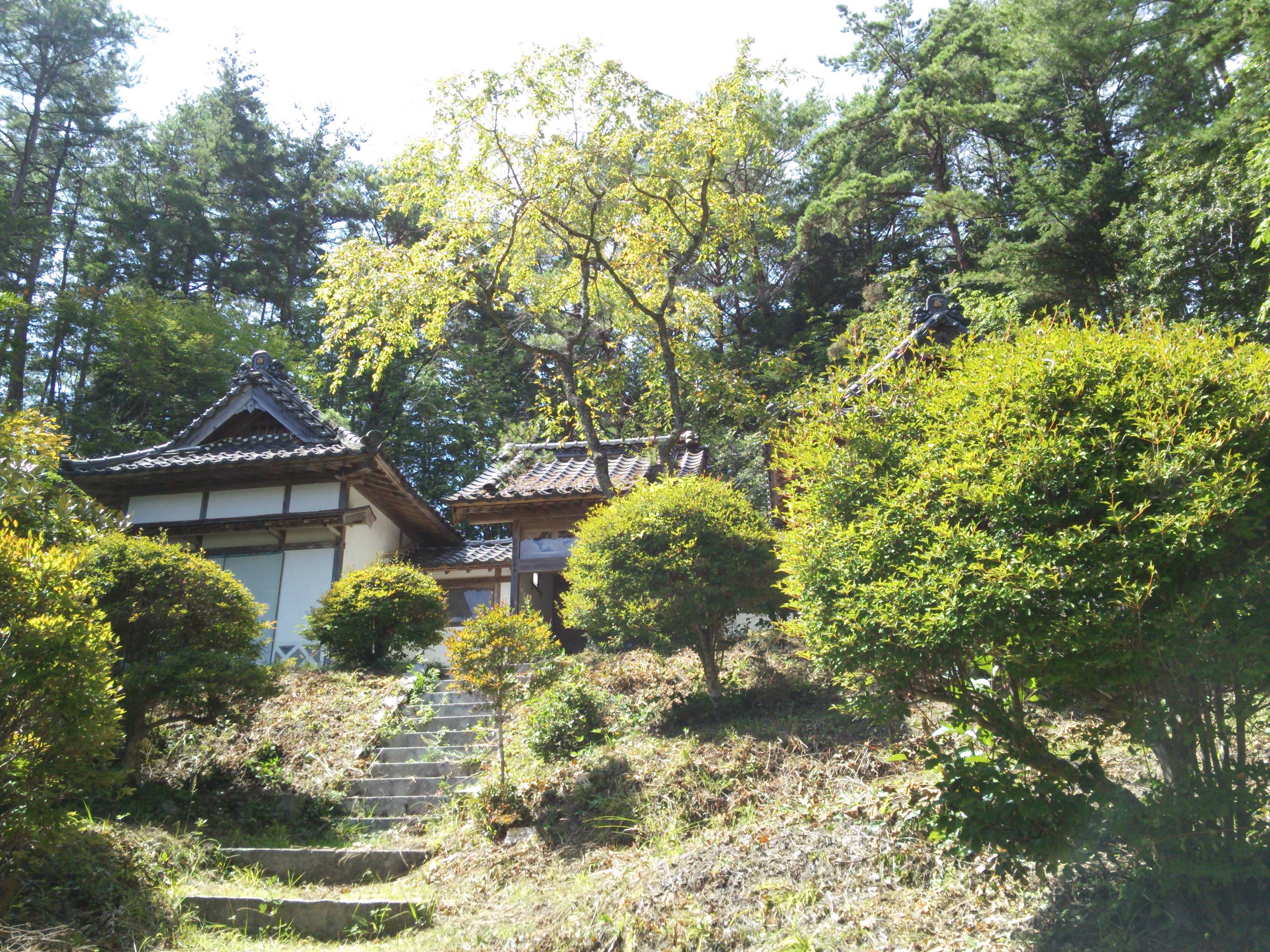
Exploring Architecture and Landscape Across Chubu
Architecture in Chubu is shaped by a remarkable range of landscapes. The region extends from the dense urban fabric of Nagoya to coastal plains, agricultural settlements, forested mountains, river basins, and historic towns. Each setting presents different conditions for design, from flood management and heat reduction to mobility, cultural memory, and the preservation of productive land.
For architecture students, this variety creates an important opportunity. A graduation project can be more than an individual building proposal; it can become an investigation into how people inhabit terrain, how communities adapt to environmental change, and how constructed space participates in an existing landscape. The relationship between architecture and its surroundings often reveals the strongest ideas in emerging Japanese design.
Through exhibitions, juried reviews, and public discussion, NAGOYA Archi Fes archive offers a valuable way to follow these ideas across successive generations of students. Looking at projects from the Chubu region makes it possible to identify recurring concerns while also appreciating the distinctive response each designer brings to a site.
Reading Chubu as a living territory
Chubu cannot be understood as a single architectural context. Nagoya’s metropolitan area contains transportation infrastructure, commercial districts, industrial zones, and compact residential neighborhoods. Beyond the city, the landscape changes into rice fields, orchards, fishing villages, post towns, and mountain communities. These environments are connected by rivers and roads, yet each has a different rhythm of daily life.
The Kiso, Nagara, and Ibi river systems are especially significant. Their floodplains have supported agriculture and settlement while also requiring sophisticated water-management practices. Architecture in these areas must respond to seasonal flooding, damp conditions, levees, and the visual openness of cultivated land. A raised floor, a carefully oriented entrance, or a public path along the water can carry practical and cultural meaning at the same time.
The region’s mountains introduce another set of relationships. Forests provide timber, watershed protection, and recreational space, while steep slopes restrict development and expose the consequences of landslides or heavy rainfall. In a mountain settlement, landscape is not distant scenery. It is a source of materials, a daily working environment, and a force that determines where buildings can safely stand.
From scenery to active infrastructure
Landscape architecture is sometimes treated as an aesthetic layer added after a building has been designed. In Chubu, a more useful approach is to see landscape as active infrastructure. Soil, vegetation, waterways, shade, wind, and topography all influence the performance of a building and the comfort of its users. They can also support social life by creating shared routes, gathering spaces, and places for informal contact.
A school beside a rice field, for example, might use its courtyard as a view toward seasonal cultivation rather than enclosing itself behind a generic fence. A community center near a river could combine flood-resilient construction with terraces that allow residents to observe water levels and gather during ordinary days. In both cases, the landscape becomes part of the building’s educational and civic role.
This perspective is increasingly relevant as the region faces hotter summers, intense rainfall, aging infrastructure, and population decline in rural communities. Planting strategies, permeable ground surfaces, shaded outdoor rooms, and adaptable structures can reduce environmental stress while improving public experience. Good design connects ecological performance with the emotional and cultural qualities of place.
What student projects can reveal
Graduation works are useful because they often test relationships that ordinary development processes leave unexplored. Students may question the boundary between a house and a field, propose new uses for a declining station, or reinterpret a vacant industrial site as a civic landscape. Their proposals can be speculative, yet they expose the assumptions behind familiar forms of development.
In a juried exhibition, visitors can compare how different designers respond to similar regional conditions. One project may emphasize precise site analysis and minimal intervention. Another may focus on public participation, material reuse, or a new network of paths. A third may treat the building as a long-term framework that can change as residents, climate, and local industries change.
| Regional condition | Architectural response | Landscape relationship | Social value |
|---|---|---|---|
| Flood-prone river plain | Raised or flood-adapted structures | Water channels, wetlands, and accessible embankments | Safety, environmental awareness, and recreation |
| Dense urban district | Mixed-use infill and shaded public space | Street trees, pocket gardens, and connected pedestrian routes | Thermal comfort and everyday interaction |
| Aging rural settlement | Reuse of vacant houses and communal facilities | Productive gardens, field edges, and walking paths | Local identity and intergenerational exchange |
| Mountain community | Compact, slope-sensitive construction | Forest management and watershed protection | Resilience and continuity of local practices |
| Coastal industrial area | Flexible public or cultural buildings | Waterfront access, wind protection, and habitat restoration | New civic use and connection to maritime history |
The table also shows why a building cannot be evaluated separately from its setting. A visually compelling object may have limited value if it blocks a public route, ignores drainage, or depends on materials that are difficult to maintain locally. Conversely, a modest project can be powerful when it strengthens existing ecological and social systems.
Designing with memory and material
The connection between architecture and landscape also involves memory. Chubu contains historic streets, shrine precincts, castle towns, irrigation networks, post stations, and industrial heritage. These places are not frozen images from the past. They continue to evolve through repair, adaptation, tourism, local commerce, and changes in population.
Architecture students often work productively with this layered history when they avoid simple imitation. A new building may borrow the scale of a traditional streetscape without copying its details. It may reuse timber from a dismantled structure, frame a view toward a familiar mountain, or preserve an old wall as part of a new public route. Such decisions make history tangible while allowing contemporary activities to take place.
Material selection can deepen this connection. Local timber, ceramic products, stone, earth, and recycled components each carry environmental and cultural implications. Their use should involve more than attaching a regional label to a design. Students need to examine availability, labor, maintenance, carbon impact, and the knowledge required to work with each material. In this way, material becomes a link between landscape resources and architectural expression.
Moving beyond the isolated building
Many strong proposals for Chubu are likely to operate at several scales at once. At the smallest scale, a project may improve the threshold between a home and a lane. At the neighborhood scale, it may organize shared gardens, drainage routes, or spaces for local events. At the regional scale, it may reconnect settlements through ecological corridors, cycling routes, or networks of reused public buildings.
This multi-scalar thinking is important because landscape processes do not stop at property lines. A tree canopy can continue along a street, a river can connect several municipalities, and a local forestry economy can influence construction choices far from the mountain where timber is harvested. Architecture becomes more responsible when it acknowledges these relationships instead of presenting the site as an isolated parcel.
It also changes how success is measured. The quality of a project may depend on whether it supports biodiversity, reduces maintenance burdens, encourages walking, or creates a stronger sense of belonging. Plans should account for ordinary users, including children, older residents, workers, visitors, and people with limited mobility. Inclusive circulation and clear public access are central parts of landscape-sensitive design.
Learning through exhibitions and critique
An architecture exhibition makes these questions visible through drawings, models, photographs, material samples, and spoken explanations. Visitors can see how a student translates fieldwork into a spatial proposal. They can examine whether a river study affects the building section, whether a social survey changes the program, or whether a landscape strategy remains convincing at the scale of construction details.
Professional jurors add another layer of evaluation. Their experience can test the relationship between ambition and feasibility, asking whether a proposal can be built, maintained, funded, and inhabited. Critique can also reveal when a project uses landscape as a visual theme without engaging with its ecological processes or local communities. This exchange helps students refine both their design judgment and their ability to communicate complex ideas.
For the public, such exhibitions provide access to architectural thinking before it becomes part of established practice. Residents may recognize familiar places from unexpected perspectives, while younger visitors may see design as a way to address environmental and social concerns. The exhibition therefore becomes a civic forum where the future of regional space can be discussed through concrete proposals.
Practical ways to strengthen site-based design
Students and educators can make the connection between architecture and landscape more precise by treating research as a design tool rather than a preliminary exercise. A site visit should record more than dimensions and photographs. It can document sounds, shade patterns, drainage, seasonal activities, informal paths, local construction methods, and the different ways people occupy the same place throughout the day.
The following approaches help turn observation into a coherent project:
- Map water movement, sunlight, prevailing winds, vegetation, and pedestrian activity before fixing the building footprint.
- Interview residents, craftspeople, farmers, shop owners, and local officials to understand routines that drawings may overlook.
- Study the site across seasons, especially where agriculture, tourism, festivals, flooding, or snow alter public use.
- Test several scales of intervention, from material details and thresholds to streets, watersheds, and regional networks.
- Design for maintenance by identifying who will care for planted areas, public furniture, drainage systems, and shared facilities.
These methods are especially valuable in graduation design, where a clear argument matters as much as a finished form. A proposal grounded in evidence can still be imaginative, but its imagination grows from the character of the place rather than being imposed upon it.
A regional conversation with wider relevance
The issues visible in Chubu are shared by many regions in Japan and elsewhere. Urban expansion, rural depopulation, climate risk, aging infrastructure, and the loss of local knowledge require designers to think across conventional professional boundaries. Landscape architects, architects, planners, engineers, residents, and craftspeople all contribute to the making of resilient places.
Yet regional specificity remains essential. Solutions developed for a dense Nagoya neighborhood may not suit a mountain village or a tidal plain. The value of Chubu’s architectural culture lies in its range of conditions and in the ability of students to respond to them without reducing the region to a single identity. Each project can reveal a different relationship between habitation, ecology, history, and movement.
By presenting these investigations publicly, NAGOYA Archi Fes helps establish architecture as an ongoing conversation rather than a finished object. Its exhibitions encourage attention to the places where design begins: the river edge, the field boundary, the forest road, the neighborhood street, and the communities that give those settings meaning.
Explore the projects, discussions, and exhibition resources connected with NAGOYA Archi Fes, and use them as a starting point for closer observation of the landscapes around you. Whether you are a student developing a graduation proposal, an educator guiding site research, or a visitor discovering new regional perspectives, engage with the work, attend the exhibition when possible, and contribute to the continuing dialogue about how Chubu should be inhabited and cared for.